

I spent much of today in confusion. For starters, I turned the wrong way out of the motel only to find a sign indicating I was on ME-11 south, so naturally I turned around (given my unshakeable certainty that Madawaska is, in fact, north of Medway). Yet, after turning around I found myself riding into the sun! What the heck? The sun is always in the southern half of the sky! Yet, soon enough, though mostly blinded by the bedazzling morning sun, I passed a ME-11 north sign; so on I went.
Although I had studied the region thoroughly (so I thought!) in the DeLorme’s Gazetteer before I left home, I somehow convinced myself that ME-11 goes directly north from Medway; so imagine my surprise when I began seeing signs for the Katahdin Woods and Waters National Monument, and Sherman, and Patten — all places I knew to be well east of Medway. Yet, the occasional ME-11 North signs continued to beckon me onward. It was only after arriving at my hotel in St. Agatha (just south of Madawaska on Long Lake) late this afternoon that I could access the Maine map I keep in the bike, which clearly demonstrated that ME-11 does indeed move east to Sherman and Patten before turning north to Ashland and Eagle Lake (which explains why I was riding into the sun in the morning!). So, it turned out that I got where I was going today in spite of myself.
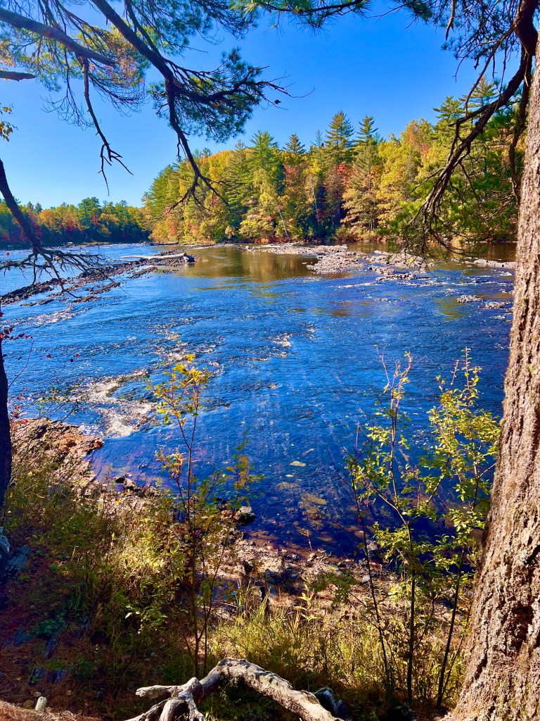
Anyway, soon after leaving Medway on ME-11 north, one reaches the Grindstone Falls rest area on the left. This is a spectacular ledge drop in the West Branch of the Penobscot River which can reach class IV in high water, thus becoming a highlight of any canoe trip down the West Branch. With all of Maine in a drought, however, today the ledges were visible all across the rapid.
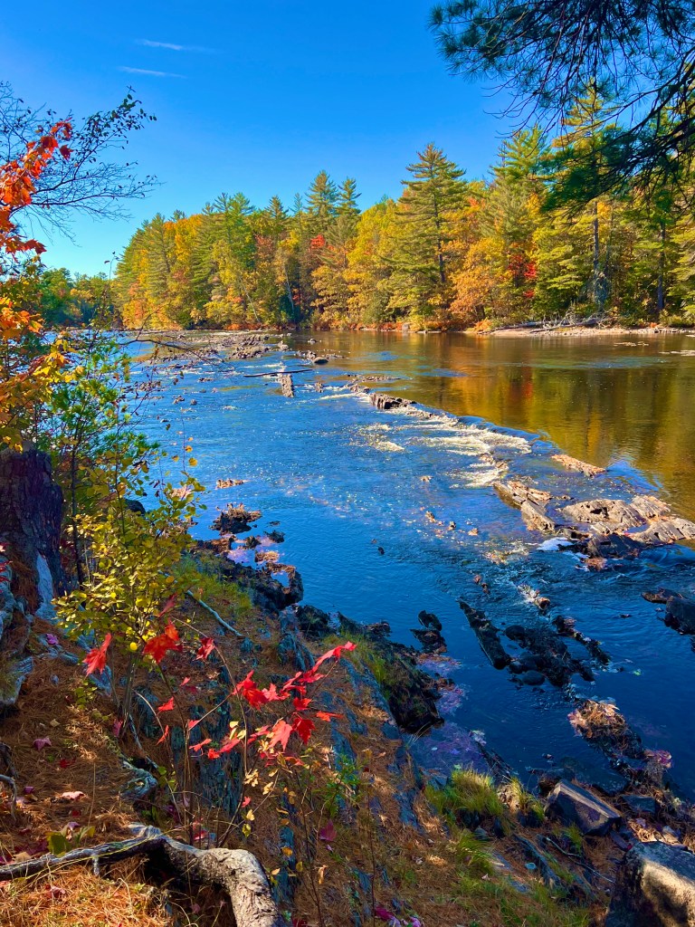
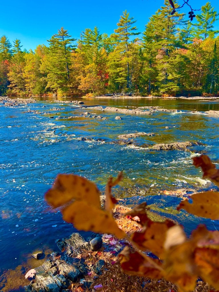
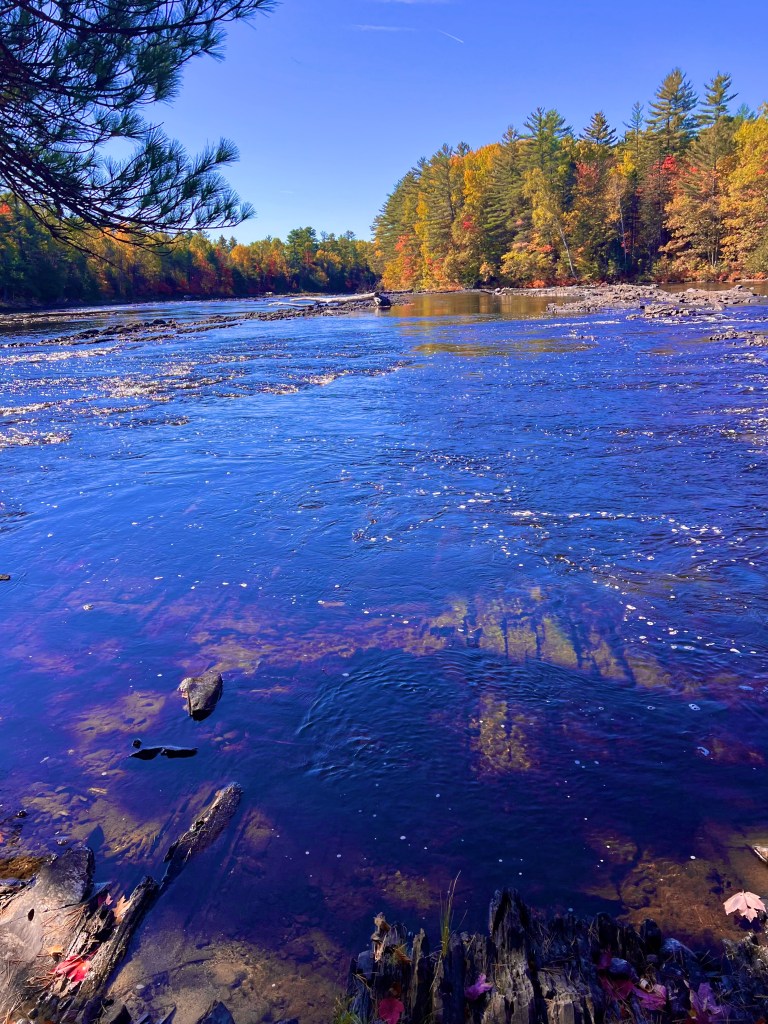
You can see how these gnarly pre-Cambrian ledges could, given a high enough flow, roust up some serious whitewater!

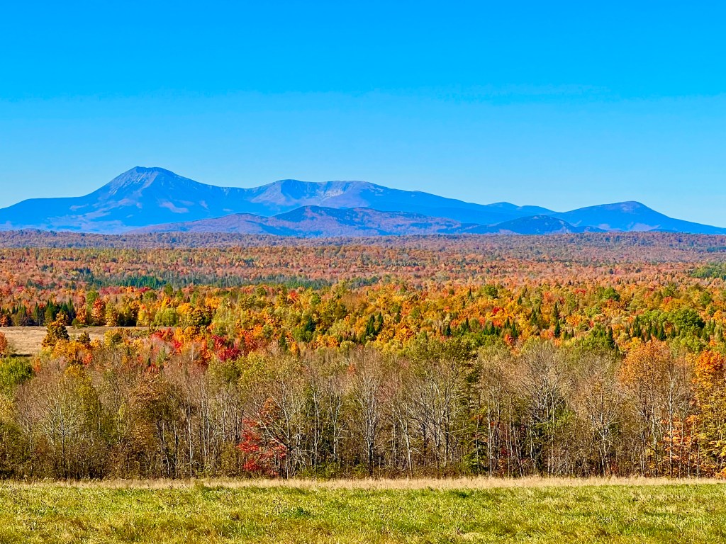
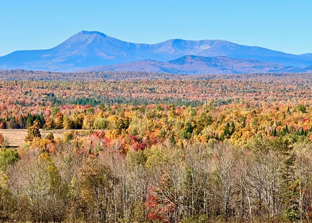
The ride from Sherman north to Ashland was spectacular with the fall foliage, and I have to add ME-11 to my list of top motorbike roads in Maine — twisty, hilly, with beautiful new pavement, the road offered one magnificent peak-foliage vista after another, each too grand for the camera to capture in a single frame. There is one exceptional pull-off on this route which offers a stunning view of the Mt. Katahdin range to the west:
After riding through Ashland and Eagle Lake, ME-11 ends in a junction with US-1 at its northern terminus in Fort Kent (the southern terminus of US-1 is, of course, Key West, Florida — and you can ride it all the way from here to there if you are so inclined!). Almost immediately upon accessing US-1, the old blockhouse for which the town is named appears on the left:
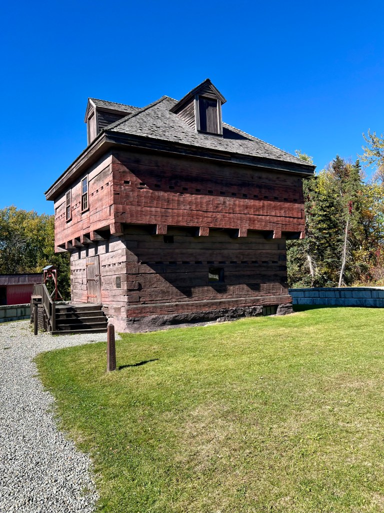
Built to defend Maine from the British in the territorial dispute which became known as the Bloodless Aroostook War (settled by the Webster-Ashburton treaty in 1840 with no shots fired), the fort later became a private home, which accounts for the decidedly unfortress-like dormers on the roof.

The short journey from Fort Kent to Madawaska offers lovely views of the St. John River (the international border with Canada) on the left. The Four Corners Park in Madawaska soon appears on the right, and I will share photos of it upon my return to Medway tomorrow.

Looks like you saw some nice fall colors on your trip.
LikeLike